Ficheru:Mediterranean Sea political map-es.svg

Tamañu de la vista previa PNG d'esti ficheru SVG: 800 × 585 pixels. Otres resoluciones: 320 × 234 pixels | 640 × 468 pixels | 1024 × 749 pixels | 1280 × 936 pixels | 2560 × 1872 pixels | 2046 × 1496 pixels.
Ficheru orixinal (ficheru SVG, 2046 × 1496 píxels nominales, tamañu de ficheru: 1,1 MB)
| Descripción |
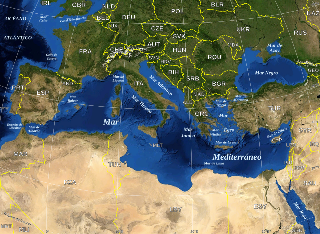
English: Map in Spanish of the Mediterranean Sea, with the borders and the name of the States following the ISO 3166-1 Alpha-3 code. Español: Mapa en español del Mar Mediterraneo con las fronteras y los nombres de los estados siguiendo el código ISO 3166-1 Alpha-3. |
| Data | (UTC) |
| Fonte | |
| Autor |
|
| Esta ye una imaxe retocada, lo que significa que foi modificada dixitalmente de la so versión orixinal. Modificaciones: Versión en español. La orixinal pue vese equí: Mediterranean Sea political map-en.svg:
|
| Esta imagen se encuentra en el dominio público porque es una captura de pantalla del software de globo terráqueo de la NASA, World Wind, que utiliza una capa de dominio público, como Blue Marble, MODIS, Landsat, SRTM, USGS o GLOBE.
|
 |
| This work was previously under Public Domain, or a Free License. It has been digitally enhanced and/or modified. This derivative work has been (or is hereby) released into the public domain by its author, [[:{{{1}}}:User:{{{3}}}|{{{3}}}]] at the [[:{{{1}}}:|{{{2}}}]] project. This applies worldwide. In some countries this is not legally possible; if so:
|
Rexistru de xubíes orixinal
This image is a derivative work of the following images:
- File:Mediterranean_Sea_political_map-en.svg licensed with PD-WorldWind, PD-retouched-user-w
- 2008-05-19T16:18:12Z Sting 2046x1496 (1148854 Bytes) "Tropic of Cancer" label correction
- 2007-06-21T01:01:36Z Sting 2046x1496 (1148419 Bytes) {{Information |Description=Map in English of the [[:en:Mediterranean Sea|Mediterranean Sea]], with the borders and the name of the States following the ISO 3166-1 Alpha-3 code. |Source=Own work ;Background map : screenshot fr
Uploaded with derivativeFX
Historial del ficheru
Calca nuna fecha/hora pa ver el ficheru como taba daquella.
| Data/Hora | Miniatura | Dimensiones | Usuariu | Comentariu | |
|---|---|---|---|---|---|
| actual | 18:32 13 xun 2010 | | 2046 × 1496 (1,1 MB) | Edoarado | Corregido error en "Océano Atlántico", el texto aparecía del revés. |
| 18:16 13 xun 2010 |  | 2046 × 1496 (1,1 MB) | Edoarado | {{Information |Description={{en|Map in Spanish of the Mediterranean Sea, with the borders and the name of the States following the ISO 3166-1 Alpha-3 code.}} {{es|Mapa en español del Mar Mediterraneo con |
Usu del ficheru
La páxina siguiente usa esti ficheru:
Usu global del ficheru
Estes otres wikis usen esti ficheru:
- Usu en ar.wikipedia.org
- Usu en arz.wikipedia.org
- Usu en ca.wikipedia.org
- Usu en el.wikipedia.org
- Usu en en.wikipedia.org
- Usu en es.wikipedia.org
- Usu en eu.wikipedia.org
- Usu en fi.wiktionary.org
- Usu en fr.wikinews.org
- Usu en ga.wikipedia.org
- Usu en gl.wikipedia.org
- Usu en ha.wikipedia.org
- Usu en ia.wikipedia.org
- Usu en kab.wikipedia.org
- Usu en la.wikipedia.org
- Usu en mzn.wikipedia.org
- Usu en pnb.wikipedia.org
- Usu en pt.wikipedia.org
- Usu en shi.wikipedia.org
- Usu en vec.wikipedia.org
- Usu en www.wikidata.org