Ficheru:NPS american-samoa-regional-map.jpg

Tamañu d'esta previsualización: 800 × 446 pixels. Otres resoluciones: 320 × 179 pixels | 640 × 357 pixels | 925 × 516 pixels.
Ficheru orixinal (925 × 516 píxels, tamañu de ficheru: 62 kB, triba MIME: image/jpeg)
Resume
| Descripción |
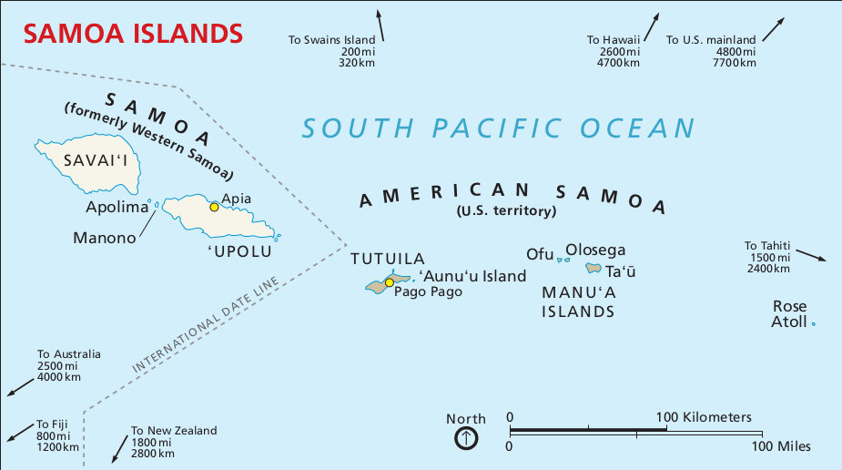
English: Regional map, showing the islands of American Samoa in relation to Western Samoa and other points of interest. |
| Data | |
| Fonte | U.S. National Park Service (http://npmaps.com/wp-content/uploads/american-samoa-regional-map.jpg) |
| Autor | U.S. National Park Service, restoration/cleanup by Matt Holly |
| Otres versiones |
 |
Llicencia
| This image or media file contains material based on a work of a National Park Service employee, created as part of that person's official duties. As a work of the U.S. federal government, such work is in the public domain in the United States. See the NPS website and NPS copyright policy for more information. |
Historial del ficheru
Calca nuna fecha/hora pa ver el ficheru como taba daquella.
| Data/Hora | Miniatura | Dimensiones | Usuariu | Comentariu | |
|---|---|---|---|---|---|
| actual | 18:35 13 may 2017 | | 925 × 516 (62 kB) | RKBot | =={{int:filedesc}}== {{Information |description= {{en|1=Regional map, showing the islands of American Samoa in relation to Western Samoa and other points of interest.}} |date= 2016-02-22 |source= U.S. National Park Service (http://npmaps.com/wp-content... |
| 18:34 13 may 2017 |  | 925 × 516 (62 kB) | RKBot | =={{int:filedesc}}== {{Information |description= {{en|1=Regional map, showing the islands of American Samoa in relation to Western Samoa and other points of interest.}} |date= 2016-02-22 |source= U.S. National Park Service (http://npmaps.com/wp-content... |
Usu del ficheru
La páxina siguiente usa esti ficheru: