Ficheru:Africa-countries-western.png
Nun ta disponible con mayor resolución.
Africa-countries-western.png (360 × 392 píxels, tamañu de ficheru: 10 kB, triba MIME: image/png)

|
File:Africa-countries-western.svg es una versión vectorial de este archivo. Debería usarse esa versión en lugar de este archivo PNG, cuando sea mejor.
File:Africa-countries-western.png → File:Africa-countries-western.svg
Para más información, lee Ayuda:SVG. |
 |
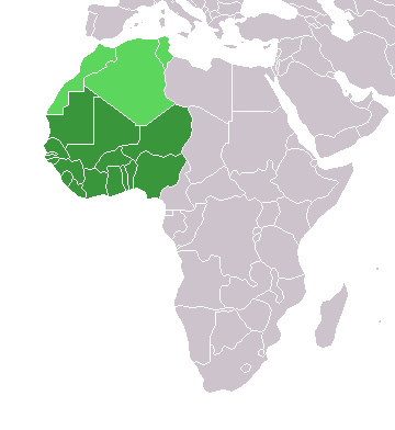
Map of countries in Western Africa.
Originally uploaded to the English Wikipedia:
- 11:32, 3 Feb 2005 . . Lucidity (13890 bytes) (Map of countries in Western Africa)
- 11:12, 3 Feb 2005 . . Lucidity (13885 bytes) (Map of countries in Western Africa)
where it was tagged by Lucidity as GFDL. This map is a modification of Image:BlankMap-World.png.

|
Autorízase la copia, distribución y/o cambéu d'esti documentu baxo los términos de la Llicencia de documentación llibre GNU, versión 1.2 o cualesquier otra que nel futuru espublice la Free Software Foundation; ensin seiciones invariables, testos de portada, nin testos de contraportada. S'inclúi una copia de la llicencia na seición titulada GNU Free Documentation License. |
| Esti ficheru ta disponible baxo la llicencia Creative Commons Reconocimientu-Compartir igual 3.0 xenérica. | ||
| ||
| Esta etiqueta de llicencia s'amestó a esti ficheru como parte del anovamientu de la llicencia GFDL. |
.
Historial del ficheru
Calca nuna fecha/hora pa ver el ficheru como taba daquella.
| Data/Hora | Miniatura | Dimensiones | Usuariu | Comentariu | |
|---|---|---|---|---|---|
| actual | 19:10 17 mar 2018 | | 360 × 392 (10 kB) | Maphobbyist | Upload |
| 23:02 29 och 2017 |  | 360 × 392 (8 kB) | أنس | WS current status | |
| 17:30 13 xin 2014 |  | 360 × 392 (10 kB) | VVVF | As File:LocationWesternAfrica.png | |
| 20:06 9 xnt 2011 |  | 360 × 392 (13 kB) | Maphobbyist | South Sudan has become independent on July 9, 2011. Sudan and South Sudan are shown with the new international border between them. | |
| 21:35 31 mar 2011 |  | 360 × 392 (13 kB) | Hoshie | added Cabinda (Angola) and Montenengro to the map. | |
| 11:13 5 may 2006 |  | 360 × 392 (4 kB) | Hautala | optimized with png | |
| 21:01 2 mar 2005 |  | 360 × 392 (14 kB) | Atamari | source en:wiki |
Usu del ficheru
Nun hai páxines qu'usen esti ficheru.
Usu global del ficheru
Estes otres wikis usen esti ficheru:
- Usu en incubator.wikimedia.org
- Usu en kbd.wikipedia.org
- Usu en kk.wikipedia.org
- Usu en ko.wikipedia.org
- Usu en oc.wikipedia.org
- Usu en pt.wikipedia.org
- Usu en ru.wikipedia.org
- Usu en ru.wikinews.org
- Usu en sl.wikipedia.org
- Usu en sv.wikinews.org
- Usu en sv.wiktionary.org
- Usu en tg.wikipedia.org
- Usu en tk.wikipedia.org
- Usu en uk.wikipedia.org
- Usu en uz.wikipedia.org
- Usu en wo.wikipedia.org