Ficheru:Arghandab River Valley between Kandahar and Lashkar Gah.jpg
Tamañu d'esta previsualización: 800 × 532 pixels. Otres resoluciones: 320 × 213 pixels | 640 × 426 pixels | 1024 × 681 pixels | 1280 × 852 pixels | 2560 × 1703 pixels | 4256 × 2832 pixels.
Ficheru orixinal (4256 × 2832 píxels, tamañu de ficheru: 2,59 MB, triba MIME: image/jpeg)
Resume
| Descripción |
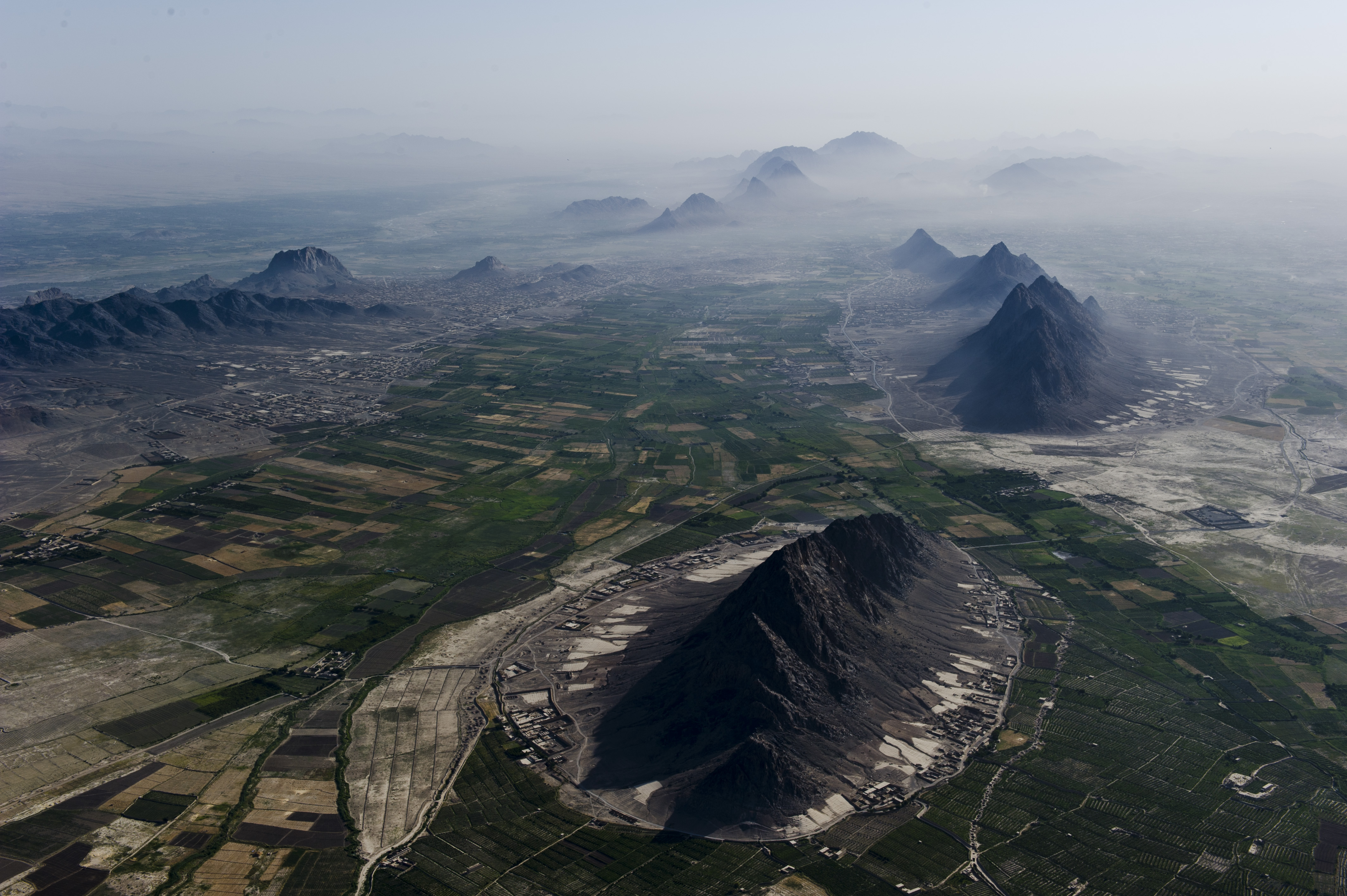
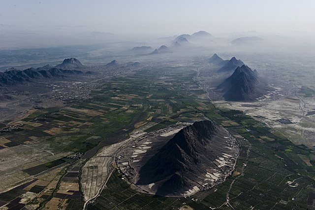
English: Mountains and plains just south-west of Kandahar city, which is beneath the haze on the right. Girowal Ghar mountain in the foreground. Arghandab River can be seen beyond the mountains at middle left. |
| Data | Tomada el 28 de xunu de 2012 |
| Fonte | https://www.flickr.com/photos/usace-tas/7548074904/ |
| Autor | Mark Ray |
Llicencia
This image or file is a work of a U.S. Army Corps of Engineers soldier or employee, taken or made as part of that person's official duties. As a work of the U.S. federal government, the image is in the public domain.
|
Historial del ficheru
Calca nuna fecha/hora pa ver el ficheru como taba daquella.
| Data/Hora | Miniatura | Dimensiones | Usuariu | Comentariu | |
|---|---|---|---|---|---|
| actual | 05:23 18 xnt 2012 | | 4256 × 2832 (2,59 MB) | Officer | {{Information |Description={{en|Arghandab River Valley between Kandahar and Lashkar Gah}} |Source=http://www.flickr.com/photos/usace-tas/7548074904/ |Date=June 28, 2012 |Author=Mark Ray |Permission= |other_versions= }} =={{int:license-header}}== {{PD-... |
Usu del ficheru
La páxina siguiente usa esti ficheru:
Usu global del ficheru
Estes otres wikis usen esti ficheru:
- Usu en ar.wikipedia.org
- Usu en azb.wikipedia.org
- Usu en az.wikipedia.org
- Usu en ca.wikipedia.org
- Usu en ceb.wikipedia.org
- Usu en ckb.wikipedia.org
- Usu en cy.wikipedia.org
- Usu en diq.wikipedia.org
- Usu en en.wikipedia.org
- Usu en en.wikivoyage.org
- Usu en eo.wikipedia.org
- Usu en es.wikipedia.org
- Usu en eu.wikipedia.org
- Usu en fa.wikipedia.org
- Usu en fi.wikipedia.org
- Usu en hu.wikipedia.org
- Usu en incubator.wikimedia.org
- Usu en it.wikipedia.org
- Usu en ja.wikipedia.org
- Usu en ka.wikipedia.org
- Usu en lv.wikipedia.org
- Usu en mk.wikipedia.org
- Usu en ms.wikipedia.org
- Usu en mzn.wikipedia.org
- Usu en no.wikipedia.org
- Usu en os.wikipedia.org
- Usu en ps.wikipedia.org
- Usu en pt.wikipedia.org
- Usu en ro.wikipedia.org
- Usu en ru.wikipedia.org
- Usu en sd.wikipedia.org
- Usu en sr.wikipedia.org
- Usu en sv.wikipedia.org
- Usu en ta.wikipedia.org
- Usu en tg.wikipedia.org
- Usu en tr.wikipedia.org
- Usu en uk.wikipedia.org
- Usu en ur.wikipedia.org
Ver más usos globales d'esti ficheru.