Ficheru:Chad Topography.png

Tamañu d'esta previsualización: 397 × 599 pixels. Otres resoluciones: 159 × 240 pixels | 318 × 480 pixels | 509 × 768 pixels | 678 × 1024 pixels | 1574 × 2375 pixels.
Ficheru orixinal (1574 × 2375 píxels, tamañu de ficheru: 4,01 MB, triba MIME: image/png)
Resume
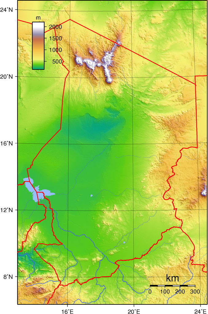
| Descripción | Topographic map of Chad. Created with GMT from GLOBE data. |
| Data | |
| Fonte | Trabayu propiu |
| Autor | Sadalmelik |
Llicencia
| L'autor d'esta obra, I, Sadalmelik, la lliberó como dominiu públicu. Esto s'aplica nel mundu ensembre. En dellos países seique esto nun seya posible llegalmente; nesti casu: I, Sadalmelik da a cualesquier persona permisu pa usar esta obra pa cualesquier propósitu, ensin denguna condición, menos si eses condiciones requierense pola llei. |
| Annotations | This image is annotated: View the annotations at Commons |
Historial del ficheru
Calca nuna fecha/hora pa ver el ficheru como taba daquella.
| Data/Hora | Miniatura | Dimensiones | Usuariu | Comentariu | |
|---|---|---|---|---|---|
| actual | 19:23 29 xun 2007 | | 1574 × 2375 (4,01 MB) | Sadalmelik | Better data/better colours |
| 16:02 17 xun 2007 |  | 1574 × 2375 (2,89 MB) | Sadalmelik | {{Information |Description= |Source=self-made |Date= |Author= Sadalmelik }} | |
| 17:54 14 xun 2007 |  | 1574 × 2375 (2,74 MB) | Sadalmelik | {{Information |Description=Topographic map of Chad. Created with GMT from GLOBE data. |Source=self-made |Date=June 14, 2007 |Author= Sadalmelik }} Category:Maps of Chad Category:Topographic maps of Africa |
Usu del ficheru
La páxina siguiente usa esti ficheru:
Usu global del ficheru
Estes otres wikis usen esti ficheru:
- Usu en am.wikipedia.org
- Usu en avk.wikipedia.org
- Usu en en.wikipedia.org
- Usu en es.wikipedia.org
- Usu en fa.wikipedia.org
- Usu en hu.wikipedia.org
- Usu en ig.wikipedia.org
- Usu en io.wikipedia.org
- Usu en ka.wikipedia.org
- Usu en mdf.wikipedia.org
- Usu en uk.wikipedia.org
- Usu en vep.wikipedia.org