Ficheru:Francophone Africa.png
Tamañu d'esta previsualización: 600 × 599 pixels. Otres resoluciones: 240 × 240 pixels | 480 × 480 pixels | 997 × 996 pixels.
Ficheru orixinal (997 × 996 píxels, tamañu de ficheru: 158 kB, triba MIME: image/png)

|
File:Francophone Africa.svg es una versión vectorial de este archivo. Debería usarse esa versión en lugar de este archivo PNG, cuando sea mejor.
File:Francophone Africa.png → File:Francophone Africa.svg
Para más información, lee Ayuda:SVG. |
 |
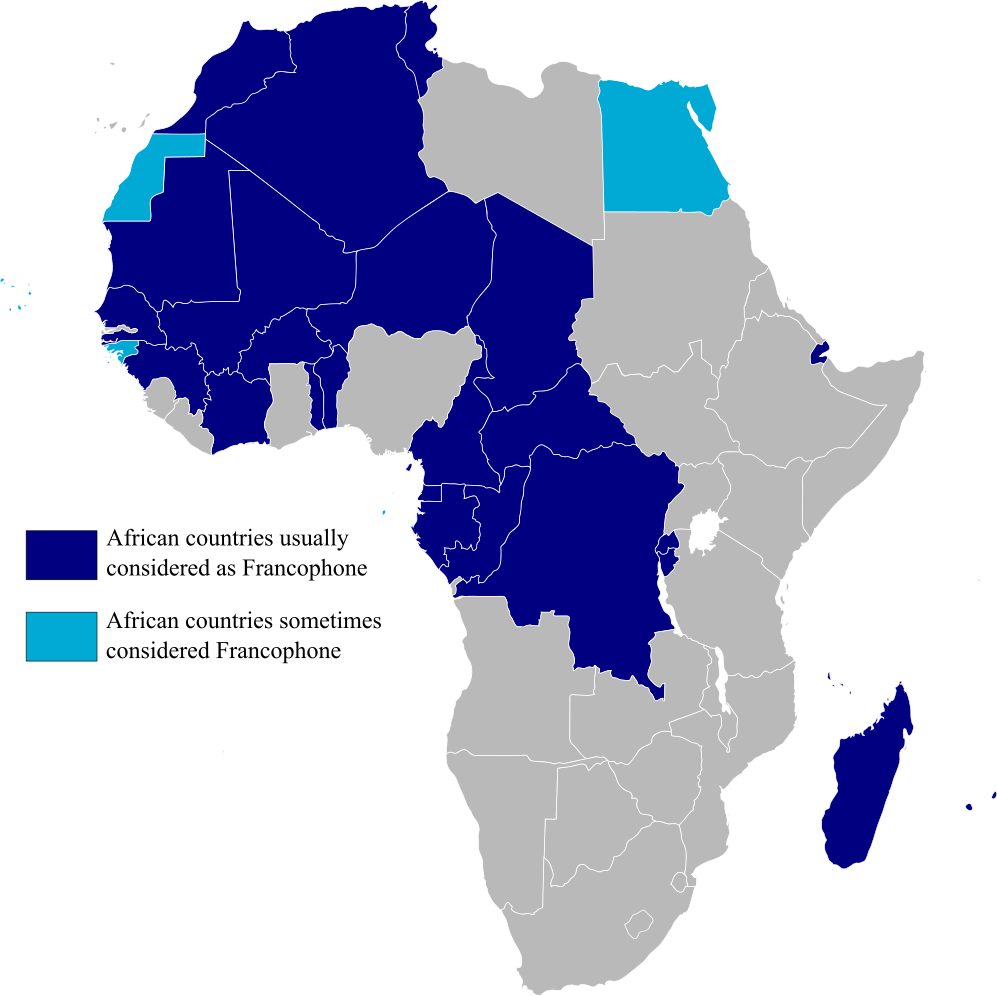
Map highlighting Francophone Africa, made by myself.
| Yo, el titular de los drechos d'autor d'esta obra, la llibero como dominiu públicu. Esto s'aplica nel mundu ensembre. En dellos países seique esto nun seya posible llegalmente; nesti casu: Doi a cualesquier persona permisu pa usar esta obra pa cualesquier propósitu, ensin denguna condición, menos si eses condiciones requierense pola llei. |
Historial del ficheru
Calca nuna fecha/hora pa ver el ficheru como taba daquella.
| Data/Hora | Miniatura | Dimensiones | Usuariu | Comentariu | |
|---|---|---|---|---|---|
| actual | 15:29 11 feb 2023 | | 997 × 996 (158 kB) | +JMJ+ | rephrased the text |
| 15:21 11 feb 2023 |  | 997 × 996 (157 kB) | +JMJ+ | Better base map - File:BlankMap-Africa.svg | |
| 21:57 19 xnt 2011 |  | 360 × 388 (14 kB) | Rosss | Added South Sudan | |
| 01:09 15 ago 2007 |  | 360 × 392 (14 kB) | Rosss | Added Réunion, Mauritius, Seychelles, Comoros, Mayotte, Scattered Islands, Cape Verde, Guinea Bisau, Sao Tome e Principe, and the insular part of Equatorial Guinea. | |
| 17:37 20 pay 2006 |  | 360 × 392 (13 kB) | Aaker | Map highlighting Francophone Africa. Made by myself. | |
| 17:36 20 pay 2006 |  | 360 × 392 (13 kB) | Aaker | Map highlighting Francophone Africa, made by myself. | |
| 17:33 20 pay 2006 |  | 360 × 392 (13 kB) | Aaker | Map highlighting Francophone Africa, made by myself, 2006. Carte marquant l'Afrique francophone. | |
| 17:32 20 pay 2006 |  | 360 × 392 (13 kB) | Aaker | Map highlighting Francophone Africa, made by myself, 2006. Carte marquant l'Afrique francophone. | |
| 15:46 11 pay 2006 |  | 360 × 392 (13 kB) | Aaker | Map highlighting Francophone Africa, made by myself. |
Usu del ficheru
La páxina siguiente usa esti ficheru:
Usu global del ficheru
Estes otres wikis usen esti ficheru:
- Usu en ar.wikipedia.org
- Usu en de.wikipedia.org
- Usu en en.wikipedia.org
- Usu en es.wikipedia.org
- Usu en fa.wikipedia.org
- Usu en he.wikipedia.org
- Usu en hy.wikipedia.org
- Usu en hyw.wikipedia.org
- Usu en it.wikipedia.org
- Usu en ja.wikipedia.org
- Usu en mr.wikipedia.org
- Usu en pt.wikipedia.org
- Usu en tl.wikipedia.org
- Usu en tr.wiktionary.org
- Usu en ur.wikipedia.org
- Usu en zh.wikipedia.org