Ficheru:Island of Ireland location map Donegal.svg

Tamañu de la vista previa PNG d'esti ficheru SVG: 481 × 599 pixels. Otres resoluciones: 192 × 240 pixels | 385 × 480 pixels | 616 × 768 pixels | 822 × 1024 pixels | 1643 × 2048 pixels | 1450 × 1807 pixels.
Ficheru orixinal (ficheru SVG, 1450 × 1807 píxels nominales, tamañu de ficheru: 642 kB)
| Descripción |
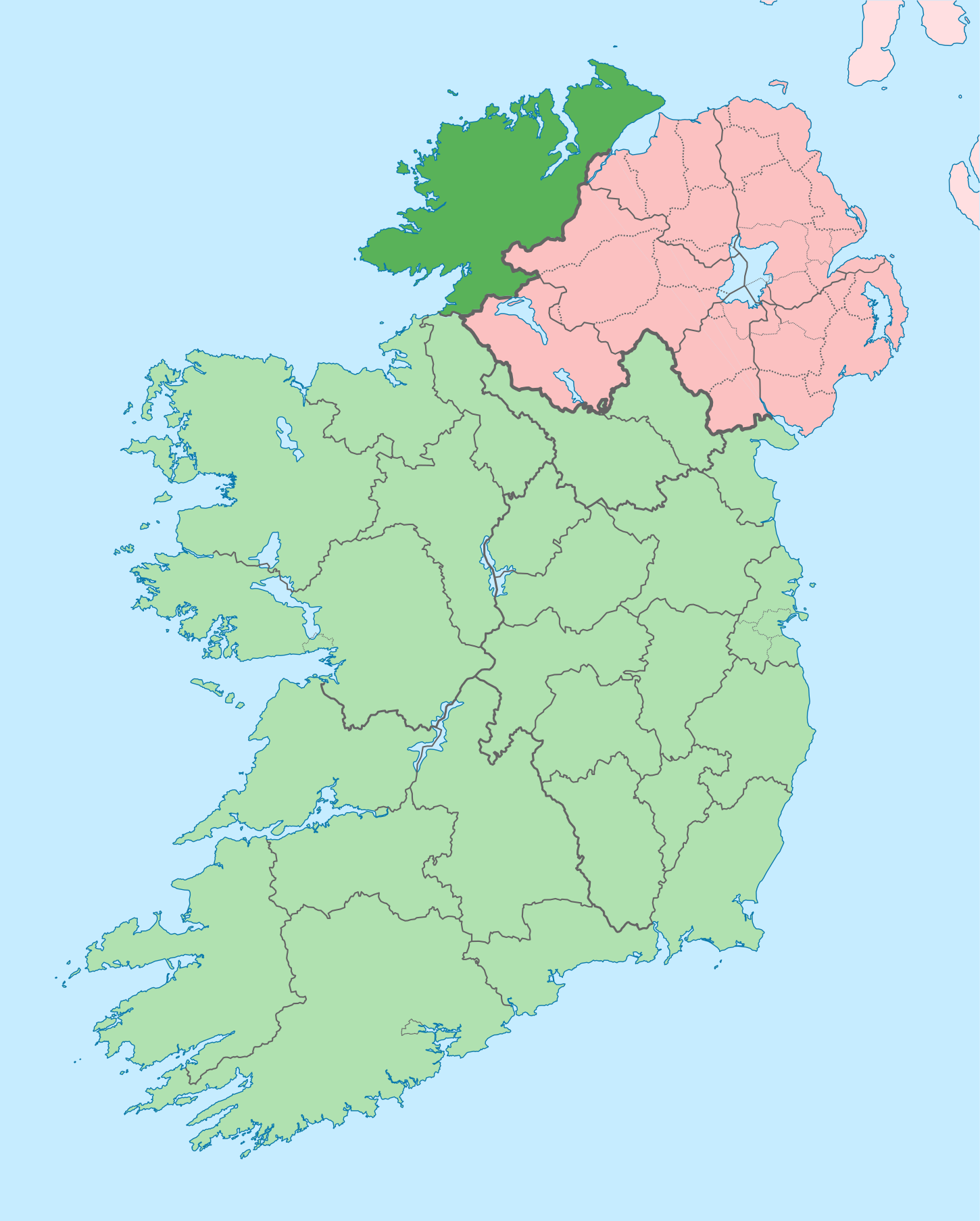
English: The island of Ireland, showing international border between Ireland and Northern Ireland, traditional provinces, traditional counties, and local authority areas in Ireland and Northern Ireland. |
| Data | (UTC) |
| Fonte | |
| Autor |
|
| Esta ye una imaxe retocada, lo que significa que foi modificada dixitalmente de la so versión orixinal. Modificaciones: Coloured in regions with county of article highlighted. La orixinal pue vese equí: Island of Ireland location map.svg:
|
Yo, el titular de los drechos d'autor d'esta obra, la espublizo baxo la siguiente llicencia:
Esti ficheru ta disponible baxo la llicencia Creative Commons Reconocimientu-Compartir igual 3.0 xenérica.
- Ye llibre:
- pa compartir – pa copiar, distribuir y comunicar públicamente la obra
- pa remezclar – p'adautar la obra
- Baxo les condiciones siguientes:
- reconocimientu – Tienes de dar el créitu apropiáu, apurrir un enllaz a la llicencia ya indicar si realizasti dalgún cambéu. Puedes faelo de cualquier mou razonable ,pero non de manera que suxera l'encontu del autor pa ti o pal usu que faigas.
- compartir igual – Si entemeces, tresformes o te bases nesti material, tienes de distribuir les tos contribuciones baxo la mesma llicencia o una compatible cola orixinal.
Rexistru de xubíes orixinal
This image is a derivative work of the following images:
- File:Island_of_Ireland_location_map.svg licensed with Cc-by-sa-3.0
- 2010-03-06T20:43:33Z Rannpháirtí anaithnid 1450x1807 (679207 Bytes) Fix incorrectly coloured isands.
- 2010-03-03T22:19:29Z Rannpháirtí anaithnid 1450x1807 (679744 Bytes) {{Information |Description={{de|Positionskarte von [[:de:Irland|Irland]]}} Quadratische Plattkarte, N-S-Streckung 170 %. Geographische Begrenzung der Karte: * N: 55.6° N * S: 51.2° N * W: 11.0° W * O: 5.0° W {{en|Location
Uploaded with derivativeFX
Historial del ficheru
Calca nuna fecha/hora pa ver el ficheru como taba daquella.
| Data/Hora | Miniatura | Dimensiones | Usuariu | Comentariu | |
|---|---|---|---|---|---|
| actual | 13:41 29 xun 2020 | | 1450 × 1807 (642 kB) | Chipmunkdavis | Further edits per the Local Government Reform Act 2014, joining both Tipperarys and both Waterfords (and removing Limerick City code). Colouring in islands, cleaning up and grouping code to remove stray objects and show Galway and Lough Ree. |
| 03:49 6 may 2016 |  | 1450 × 1807 (833 kB) | Houdinipeter | to reflect the changes of the w:Local Government Reform Act 2014 | |
| 00:43 19 xnt 2010 |  | 1450 × 1807 (815 kB) | Mabuska | {{Information |Description={{en|The island of Ireland, showing international border between Northern Ireland and Republic of Ireland, traditional provinces, traditional counties, and local authority areas in the Republic of Ireland and Northern Ireland.}} |
Usu del ficheru
La páxina siguiente usa esti ficheru:
Usu global del ficheru
Estes otres wikis usen esti ficheru:
- Usu en ar.wikipedia.org
- Usu en bg.wikipedia.org
- Usu en ca.wikipedia.org
- Comtat de Donegal
- Gaoth Dobhair
- Lifford
- Letterkenny
- Plantilla:Comtat Donegal
- Ballyshannon
- Buncrana
- Bundoran
- Ballybofey
- Carndonagh
- Donegal
- Na Rosa
- Cloch Cheann Fhaola
- Gort an Choirce
- An Fál Carrach
- Machaire Rabhartaigh
- Toraigh
- Baile na Finne
- Teileann
- Gleann Cholm Cille
- Carraig Airt
- Na Dúnaibh
- Cill Charthaigh
- Doirí Beaga
- Croithlí
- Oileán na Cruite
- Gabhla
- An Bun Beag
- Anagaire
- Ailt an Chorráin
- An Dúchoraidh
- Cionn Caslach
- Leitir Mhic an Bhaird
- Loch an Iúir
- Rann na Feirste
- An Clochán Liath
- Árainn Mhór
- Rathmullan
- Ramelton
- Milford (Donegal)
- Raphoe
- Inishowen
- Corredor de Donegal
- Killybegs
- Usu en ceb.wikipedia.org
- Usu en cs.wikipedia.org
- Usu en en.wikipedia.org
Ver más usos globales d'esti ficheru.