Ficheru:Map of Copenhagen with surroundings.png

Tamañu d'esta previsualización: 546 × 600 pixels. Otres resoluciones: 218 × 240 pixels | 437 × 480 pixels | 699 × 768 pixels | 932 × 1024 pixels | 1821 × 2001 pixels.
Ficheru orixinal (1821 × 2001 píxels, tamañu de ficheru: 1,98 MB, triba MIME: image/png)
| Descripción |
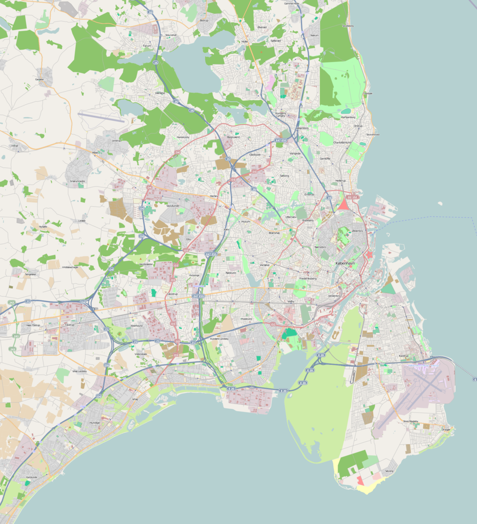
English: Map of Copenhagen with surroundings |
| Data | |
| Fonte | OpenStreetMap |
| Autor | OSM contributors |
| Permisu (Cómo reutilizar esti ficheru) |
Este archivo se encuentra bajo la licencia Creative Commons Genérica de Atribución/Compartir-Igual 2.0.
|
| Descripción |
This map was created from OpenStreetMap project data, collected by the community. This map may be incomplete, and may contain errors. Don't rely solely on it for navigation. |
|||||||||
| Data | (see file history) | |||||||||
| Fonte | openstreetmap.org | |||||||||
| Creador |
OpenStreetMap contributors |
|||||||||
| Permisu (Cómo reutilizar esti ficheru) |
OpenStreetMap data and maps are licensed under the Creative Commons Attribution-ShareAlike 2.0 license (CC-BY-SA 2.0). Este archivo se encuentra bajo la licencia Creative Commons Genérica de Atribución/Compartir-Igual 2.0.
|
|||||||||
| Datos xeotemporales | ||||||||||
| Cuadru de llende |
|
|||||||||
| Xeorreferenciador | Si nun ye apropiao, define warp_status = skip pa tapecer. | |||||||||
Historial del ficheru
Calca nuna fecha/hora pa ver el ficheru como taba daquella.
| Data/Hora | Miniatura | Dimensiones | Usuariu | Comentariu | |
|---|---|---|---|---|---|
| actual | 10:49 21 may 2009 | | 1821 × 2001 (1,98 MB) | Grillo | {{Information |Description={{en|1=Map of Copenhagen with surroundings}} |Source=OpenStreetMap |Author=OSM contributors |Date=21 May 2009 |Permission={{cc-by-sa-2.0}} |other_versions= }} <!--{{ImageUpload|full}}--> |
Usu del ficheru
La páxina siguiente usa esti ficheru:
Usu global del ficheru
Estes otres wikis usen esti ficheru:
- Usu en ceb.wikipedia.org
- Tårnby (kapital sa munisipyo sa Danismark)
- Rødovre (kapital sa munisipyo sa Danismark)
- Kongens Lyngby
- Ishøj (kapital sa munisipyo sa Danismark)
- Hvidovre
- Greve Strand
- Glostrup (kapital sa munisipyo sa Danismark)
- Charlottenlund
- Brøndbyvester
- Ballerup (kapital sa munisipyo sa Danismark)
- Albertslund (kapital sa munisipyo sa Danismark)
- Havnebadet ved Islands Brygge
- Usu en da.wikipedia.org
- Frederiksberg
- København Zoo
- Marmorkirken
- Tivoli
- Indre By (København)
- Valby
- Vanløse
- Brønshøj-Husum
- Bispebjerg
- Sundbyøster
- Sundbyvester
- Vallensbæk
- Vor Frue Kirke (København)
- Charlottenlund
- Holmens Kirke
- Det Kongelige Danske Kunstakademi
- Arken
- Vangede
- Rundetårn
- Field's
- Ørestad
- Nationalmuseet
- Værløse Kirke
- Det Kongelige Danske Musikkonservatorium
- Hellerup
- Holte
- Sundby Idrætspark
- Parken
- Rigshospitalet
- Østerbro
- Københavns åbne Gymnasium
- Dyssegård
- Kongens Lyngby
- Rødovre Gymnasium
- Den Hirschsprungske Samling
- Høje-Taastrup
- Hvidovre
- Jesuskirken
Ver más usos globales d'esti ficheru.