Ficheru:Map of North Carolina NA.png
Tamañu d'esta previsualización: 776 × 600 pixels. Otres resoluciones: 311 × 240 pixels | 621 × 480 pixels | 994 × 768 pixels | 1280 × 989 pixels | 2122 × 1640 pixels.
Ficheru orixinal (2122 × 1640 píxels, tamañu de ficheru: 1,21 MB, triba MIME: image/png)
Resume
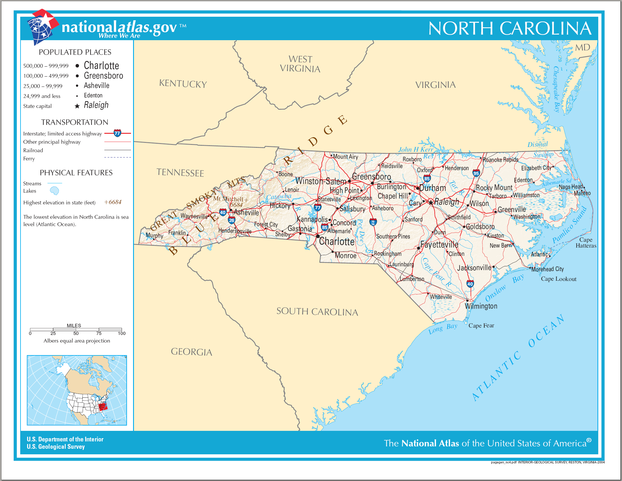
| Descripción | Map of North Carolina |
| Data | |
| Fonte | National Atlas |
| Autor | US Department of the Interior |
Llicencia
This map was obtained from an edition of the National Atlas of the United States. Like almost all works of the U.S. federal government, works from the National Atlas are in the public domain in the United States.
Online access: NationalAtlas.gov | 1970 print edition: Library of Congress, Perry-Castañeda Library
|
Historial del ficheru
Calca nuna fecha/hora pa ver el ficheru como taba daquella.
| Data/Hora | Miniatura | Dimensiones | Usuariu | Comentariu | |
|---|---|---|---|---|---|
| actual | 21:37 14 ago 2006 | | 2122 × 1640 (1,21 MB) | Huebi~commonswiki | {{Information| |Description=Map of North Carolina |Source=[http://www.nationalatlas.gov National Atlas] }} Category:Maps of the United States Category:Maps of North Carolina {{PD-USGov-Atlas}} |
Usu del ficheru
La páxina siguiente usa esti ficheru:
Usu global del ficheru
Estes otres wikis usen esti ficheru:
- Usu en be.wikipedia.org
- Usu en de.wikipedia.org
- Usu en el.wikipedia.org
- Usu en en.wikipedia.org
- Usu en eo.wikipedia.org
- Usu en fi.wikipedia.org
- Usu en fr.wikipedia.org
- Usu en hr.wiktionary.org
- Usu en hu.wikipedia.org
- Usu en incubator.wikimedia.org
- Usu en it.wikipedia.org
- Usu en ja.wikipedia.org
- Usu en lt.wikipedia.org
- Usu en new.wikipedia.org
- Usu en szl.wikipedia.org
- Usu en zea.wikipedia.org
- Usu en zh.wikipedia.org