Ficheru:Maruyama-Senmaida Stereogram.jpg

Tamañu d'esta previsualización: 800 × 480 pixels. Otra resolución: 320 × 192 pixels.
Ficheru orixinal (1000 × 600 píxels, tamañu de ficheru: 336 kB, triba MIME: image/jpeg)
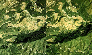
- English: Stereogram of Maruyama-Senmaida
- 日本語: 丸山千枚田付近の立体視画像
en
| Descripción |
Stereogram of Maruyama-Senmaida(a terraced rice paddy field, located on steep mountain sides) Maruyama Kiwa-cho Kumano City Mie Pref.,Japan. |
| Data | Jan.27 2007 (edit) |
| Fonte | CKK-76-6 c17b 16 & 17 in 1976,AerialPhotograph-mlitJP |
| Autor | Tawashi2006 |
| Permisu (Cómo reutilizar esti ficheru) |
AerialPhotograph-mlitJP |
ja
| Descripción |
丸山千枚田 航空写真による立体視画像(平行法) 三重県熊野市紀和町丸山地区 |
| Data | 2007年1月27日 編集 |
| Fonte | 国土情報航空写真(国土地理院)1976年度撮影 CKK-76-6 c17b 16 および 17 |
| Autor | Tawashi2006 |
| Permisu (Cómo reutilizar esti ficheru) |
AerialPhotograph-mlitJP |
| Otres versiones | なし |

|
El titular de los drechos d'autor d'esti ficheru, the Ministry of Land, Infrastructure, Transport and Tourism of Japan, permite a cualesquier persona usalu pa cualesquier propósitu, mentanto se-y reconoza al titular d'esos drechos de mou afayadizu. La redistribución, les obres derivaes, l'usu comercial y tolos demás usos tan permitíos. |
Reconocimientu:
Copyright © National Land Image Information (Color Aerial Photographs), Ministry of Land, Infrastructure, Transport and Tourism
|
 |
This image is copyrighted by the Ministry of Land, Infrastructure, Transport and Tourism of Japan. For terms of use, see the stipulation to use of National Land Information (in Japanese) and message from MLIT (in Japanese and English). When you display this image on an article, include the following phrase in the description: "Made based on National Land Image Information (Color Aerial Photographs), Ministry of Land, Infrastructure, Transport and Tourism".
|
Historial del ficheru
Calca nuna fecha/hora pa ver el ficheru como taba daquella.
| Data/Hora | Miniatura | Dimensiones | Usuariu | Comentariu | |
|---|---|---|---|---|---|
| actual | 14:52 27 xin 2007 | | 1000 × 600 (336 kB) | Tawashi2006 | *{{en|Stereogram of Maruyama-Senmaida}} *{{ja|丸山千枚田付近の立体視画像}} ===en=== {{Information| |Description = Stereogram of Maruyama-Senmaida(a terraced rice paddy field, located on steep mountain sides) <br>Maruy |
Usu del ficheru
La páxina siguiente usa esti ficheru:
Usu global del ficheru
Estes otres wikis usen esti ficheru:
- Usu en es.wikipedia.org
- Usu en fr.wikibooks.org
- Usu en no.wikipedia.org