Ficheru:North America second level political division 2.svg

Ficheru orixinal(ficheru SVG, 512 × 596 píxels nominales, tamañu de ficheru: 132 kB)

Esti ficheru ye de Wikimedia Commons y puen usalu otros proyeutos. La descripción de la páxina de descripción del ficheru s'amuesa darréu.

Resume

Descripción
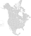
English: Map of North America and its second-level political divisions. Canadian provinces, US and Mexican states. Canada, Mexico, United States.

Non-contiguous parts of a states/provinces are "grouped" together with the main area of the state/provinces, so any state/provinces can be coloured in completion with one click anywhere on the state/provinces's area.

Also, all states/provinces have a "id" attached to them, making them easy to find. Select "find" and then enter in the state/provinces's ISO 3166-2 code in the "id" field to find it. The codes can be found here (Canada), here (USA) and here (Mexico).
Data
Fonte

Canada and US map: BlankMap-USA-states-Canada-provinces, HI closer.svg by Lokal_Profil.
Mexico map: Mexico template.svg by Mario Fuente Cid
Combined by Alex Covarrubias.

 
El código fuente de esta imagen SVG es válido.
 
Esta imagen vectorial fue creada con Inkscape, y luego editada manualmente
.
 
W3C-validity not checked.
Autor Alex Covarrubias
Permisu
(Cómo reutilizar esti ficheru)
w:es:Creative Commons
reconocimientu compartir igual
Este archivo se encuentra bajo la licencia Creative Commons Genérica de Atribución/Compartir-Igual 2.5.
Ye llibre:
  • pa compartir – pa copiar, distribuir y comunicar públicamente la obra
  • pa remezclar – p'adautar la obra
Baxo les condiciones siguientes:
  • reconocimientu – Tienes de dar el créitu apropiáu, apurrir un enllaz a la llicencia ya indicar si realizasti dalgún cambéu. Puedes faelo de cualquier mou razonable ,pero non de manera que suxera l'encontu del autor pa ti o pal usu que faigas.
  • compartir igual – Si entemeces, tresformes o te bases nesti material, tienes de distribuir les tos contribuciones baxo la mesma llicencia o una compatible cola orixinal.
Otres versiones

Derivative works of this file:

Pies

Añade una explicación corta acerca de lo que representa este archivo

Elementos representados en este archivo

representa a

Historial del ficheru

Calca nuna fecha/hora pa ver el ficheru como taba daquella.

Data/HoraMiniaturaDimensionesUsuariuComentariu
actual01:51 23 pay 2020Miniatura de la versión a fecha de 01:51 23 pay 2020512 × 596 (132 kB)Ponderosapine210Added the prominent islands of Manitoulin (Ontario) and Isle Royale (Michigan) to the Great Lakes.
23:07 1 xun 2019Miniatura de la versión a fecha de 23:07 1 xun 2019512 × 596 (130 kB)Fluffy89502added territories, made DC visible, adjusted mexican borders
12:23 4 abr 2014Miniatura de la versión a fecha de 12:23 4 abr 20141712 × 1992 (270 kB)Lommesmade the borders between the mexican subdivisions the same size as their canadian / us counterparts.
23:23 8 avi 2007Miniatura de la versión a fecha de 23:23 8 avi 20071712 × 1992 (327 kB)Lokal ProfilCode cleanup
07:55 7 och 2007Miniatura de la versión a fecha de 07:55 7 och 20071712 × 1992 (342 kB)AlexCovarrubias== Summary == {{Information |Description=Map of North America and its second-level political divisions. Canadian provinces, US and Mexican states. Canada, Mexico, United States. |Source=Canada and US map by Alan Rockefeller. Mexico map by Alex Covarrubias

Nun hai páxines qu'usen esti ficheru.

Usu global del ficheru

Metadatos