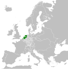
Ficheru:Republic of the Seven United Netherlands (1789).svg

Tamañu de la vista previa PNG d'esti ficheru SVG: 450 × 456 pixels. Otres resoluciones: 237 × 240 pixels | 474 × 480 pixels | 758 × 768 pixels | 1011 × 1024 pixels | 2021 × 2048 pixels.
Ficheru orixinal (ficheru SVG, 450 × 456 píxels nominales, tamañu de ficheru: 800 kB)


.svg)
.svg)
.svg)
.svg)
.svg)


.svg)
.svg)
.svg)


.png)
.png)


.svg)


.svg)

.svg)


.svg)
.svg)
.svg)
.svg)


.svg)
.png)


.svg)


.svg)
.svg)


.svg)


.svg)


.svg)
.svg)
.svg)
.svg)
.svg)
.svg)
.svg)
.svg)
_cropped.svg)
.svg)
.svg)
.svg)
.svg)
.svg)
.svg)
.svg)
.svg)
.svg)
.svg)
.svg)
.svg)
.svg)
.svg)
.svg)
.svg)
.svg)
.svg)
.svg)
.svg)
.svg)
.svg)
.svg)
.svg)
.svg)
.svg)
.svg)
.svg)
.svg)
.svg)
.svg)
.svg)
.svg)
.svg)
.svg)
.svg)
.svg)
.svg)
.svg)
.svg)
.svg)
.svg)
.svg)
.svg)
Historial del ficheru
Calca nuna fecha/hora pa ver el ficheru como taba daquella.
| Data/Hora | Miniatura | Dimensiones | Usuariu | Comentariu | |
|---|---|---|---|---|---|
| actual | 08:13 17 och 2021 | | 450 × 456 (800 kB) | Fenn-O-maniC | Fixed the Russo-Swedish border to match the Treaty of Åbo of 1743 |
| 03:45 28 set 2013 |  | 450 × 456 (802 kB) | TRAJAN 117 | +++ | |
| 14:28 18 may 2013 |  | 450 × 456 (839 kB) | TRAJAN 117 | {{Information |Description ={{en|1=The Republic of the Seven United Netherlands in 1789.}} |Source ={{own}} {{AttribSVG|Europe 1789.svg|Alphathon}} |Author =TRAJAN 117 {{created with Inkscape}} |Date =20... |
Usu del ficheru
La páxina siguiente usa esti ficheru:
Usu global del ficheru
Estes otres wikis usen esti ficheru:
- Usu en af.wikipedia.org
- Usu en ar.wikipedia.org
- Usu en arz.wikipedia.org
- Usu en azb.wikipedia.org
- Usu en az.wikipedia.org
- Usu en bg.wikipedia.org
- Usu en ckb.wikipedia.org
- Usu en cs.wikipedia.org
- Usu en de.wikipedia.org
- Usu en el.wikipedia.org
- Usu en en.wikipedia.org
- Usu en es.wikipedia.org
- Usu en et.wikipedia.org
- Usu en fi.wikipedia.org
- Usu en fr.wikipedia.org
- Usu en ga.wikipedia.org
- Usu en gl.wikipedia.org
- Usu en he.wikipedia.org
- Usu en hi.wikipedia.org
- Usu en hr.wikipedia.org
- Usu en hu.wikipedia.org
- Usu en hy.wikipedia.org
- Usu en id.wikipedia.org
- Usu en io.wikipedia.org
- Usu en it.wikipedia.org
- Usu en ja.wikipedia.org
- Usu en ko.wikipedia.org
- Usu en lfn.wikipedia.org
- Usu en lld.wikipedia.org
- Usu en lt.wikipedia.org
- Usu en lv.wikipedia.org
- Usu en ms.wikipedia.org
- Usu en mt.wikipedia.org
- Usu en nl.wikipedia.org
- Usu en pl.wikipedia.org
- Usu en pt.wikipedia.org
- Usu en ru.wikipedia.org
- Usu en simple.wikipedia.org
- Usu en sk.wikipedia.org
- Usu en sl.wikipedia.org
- Usu en th.wikipedia.org
- Usu en uk.wikipedia.org
- Usu en vi.wikipedia.org
- Usu en www.wikidata.org
- Usu en xmf.wikipedia.org
- Usu en zh-yue.wikipedia.org
Ver más usos globales d'esti ficheru.
.svg)
.svg)