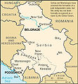
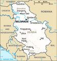
Ficheru:Serbia 2008 CIA World Factbook map with notes.png

Serbia_2008_CIA_World_Factbook_map_with_notes.png(329 × 353 píxels, tamañu de ficheru: 42 kB, triba MIME: image/png)

Esti ficheru ye de Wikimedia Commons y puen usalu otros proyeutos. La descripción de la páxina de descripción del ficheru s'amuesa darréu.

Resume

Descripción
English: CIA World Factbook map of Serbia without Kosovo — from the 2008 edition. Note the disclaimer in the upper right, and the marking of the border with Serbia as a provisional UNMIK line.

The map was taken unmodified from the Factbook, except for conversion to PNG. The notes were in the original, though they have since been removed on the CIA site.

Note: Do not upload a new image with this filename. Use Image:Serbia-CIA WFB Map.png for the later CIA World Factbook map without notes regarding the declaration of independence.
Fonte The original map was found here, but has since been modified at the source.
Autor CIA
Otres versiones

[editar]

Llicencia

Public domain
Esta imagen se encuentra en el dominio público ya que su contenido proviene de CIA World Factbook, un trabajo de la Agencia Central de Inteligencia de los Estados Unidos de América.

Bahasa Indonesia  čeština  Deutsch  eesti  English  español  Esperanto  français  galego  hrvatski  italiano  Nederlands  norsk nynorsk  polski  português  sicilianu  slovenščina  suomi  Türkçe  Zazaki  беларуская (тарашкевіца)  македонски  русский  српски / srpski  українська  ქართული  বাংলা  தமிழ்  മലയാളം  한국어  日本語  中文  中文(简体)  中文(繁體)  العربية  +/−


Rexistru de xubíes orixinal

The original description page was here. All following user names refer to en.wikipedia.
  • 2008-03-04 22:50 Anticetnik 329×353×8 (42774 bytes) Map of [[Serbia]] [[Kosovo independence|without]] [[Kosovo]] — from the [[2008]] edition of [[CIA World Factbook]]. The [https://www.cia.gov/library/publications/the-world-factbook/maps/rb-map.gif original map] can be found [https://www.cia.gov/library

Historial del ficheru

Calca nuna fecha/hora pa ver el ficheru como taba daquella.

Data/HoraMiniaturaDimensionesUsuariuComentariu
actual13:12 25 mar 2008Miniatura de la versión a fecha de 13:12 25 mar 2008329 × 353 (42 kB)Mattflaschen{{Information |Description={{en|en:CIA World Factbook map of en:Serbia without en:Kosovo — from the en:2008 edition. Note the disclaimer in the upper right, and the marking of the border with Serbia as a

Nun hai páxines qu'usen esti ficheru.

Usu global del ficheru

Estes otres wikis usen esti ficheru: