Ficheru:SeychellesBIOT1970.jpg
Nun ta disponible con mayor resolución.
SeychellesBIOT1970.jpg (780 × 283 píxels, tamañu de ficheru: 72 kB, triba MIME: image/jpeg)
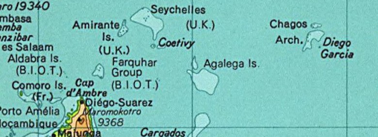
Map of the Seychelles and British Indian Ocean Territory prior to 1976. From the National Atlas as mirrored by the PCL.
This map was obtained from an edition of the National Atlas of the United States. Like almost all works of the U.S. federal government, works from the National Atlas are in the public domain in the United States.
Online access: NationalAtlas.gov | 1970 print edition: Library of Congress, Perry-Castañeda Library
|
This map was cropped from there.
Historial del ficheru
Calca nuna fecha/hora pa ver el ficheru como taba daquella.
| Data/Hora | Miniatura | Dimensiones | Usuariu | Comentariu | |
|---|---|---|---|---|---|
| actual | 02:01 13 ago 2005 | 780 × 283 (72 kB) | Hoshie | Map of the Seychelles and British Indian Ocean Territory piror to 1976. From the National Atlas as mirrored by the [http://www.lib.utexas.edu/maps/ PCL]. {{PD-USGov-Atlas}} {{PD-PCL|http://www.lib.utexas.edu/maps/national_atlas_1970/ca000244_large.jpg}} |
Usu del ficheru
La páxina siguiente usa esti ficheru:
Usu global del ficheru
Estes otres wikis usen esti ficheru:
- Usu en af.wikipedia.org
- Usu en ca.wikipedia.org
- Usu en el.wikipedia.org
- Usu en en.wikipedia.org
- Usu en eo.wikipedia.org
- Usu en id.wikipedia.org
- Usu en tl.wikipedia.org
- Usu en zh.wikipedia.org