Ficheru:SingerBuilding2.jpg
Tamañu d'esta previsualización: 416 × 599 pixels. Otres resoluciones: 167 × 240 pixels | 333 × 480 pixels | 533 × 768 pixels | 711 × 1024 pixels | 1422 × 2048 pixels | 3243 × 4670 pixels.
Ficheru orixinal (3243 × 4670 píxels, tamañu de ficheru: 1,51 MB, triba MIME: image/jpeg)
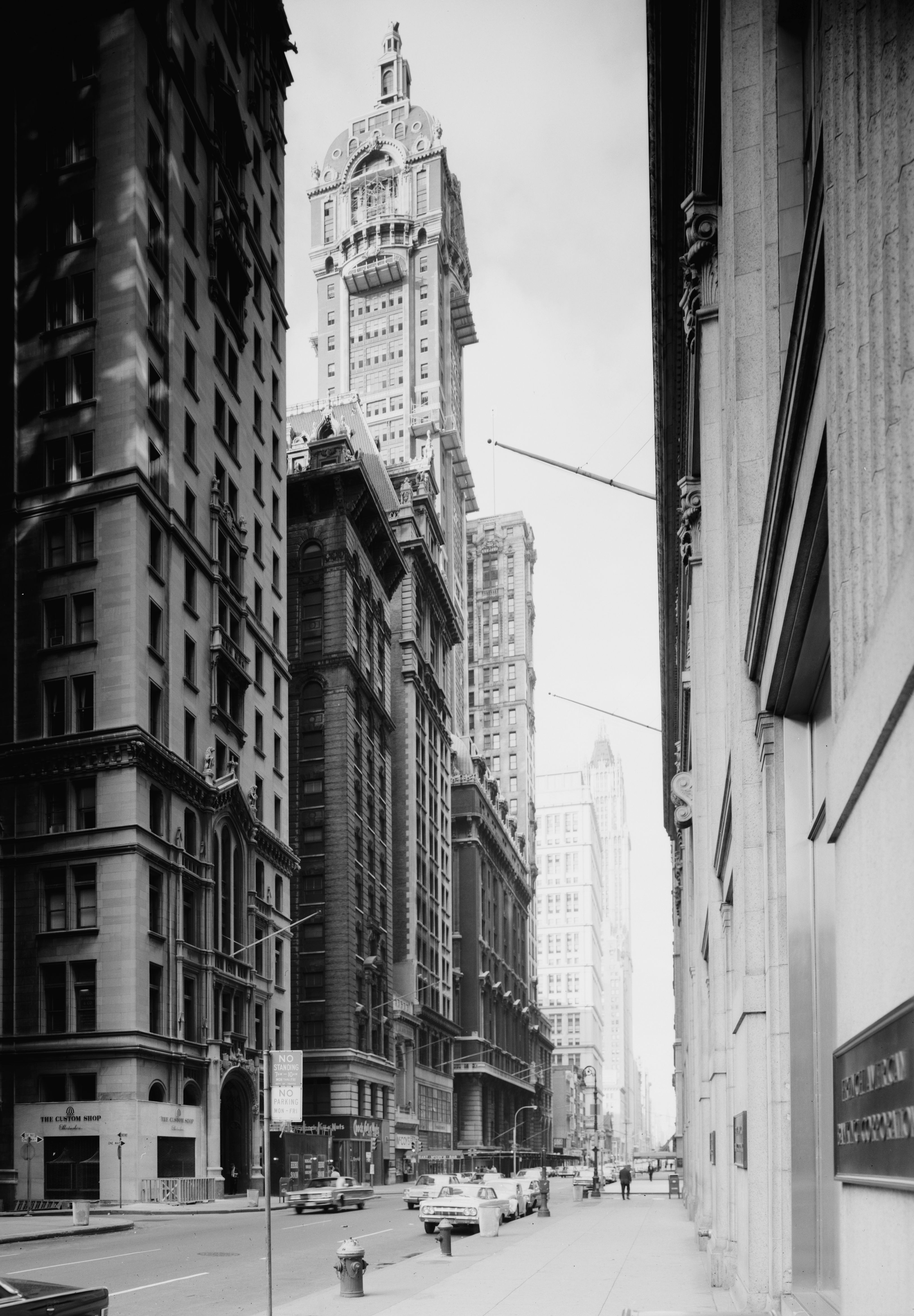
| Descripción | Singer Building | |||||
| Data | ||||||
| Fonte |
Library of Congress; Historic American Building Survey; Call number HABS NY,31-NEYO,71-1
|
|||||
| Autor | Jack E. Boucher | |||||
| Permisu (Cómo reutilizar esti ficheru) |
|


| Posición de la cámara | | Ubicación de esta y otras imágenes en: OpenStreetMap |
|---|
Historial del ficheru
Calca nuna fecha/hora pa ver el ficheru como taba daquella.
| Data/Hora | Miniatura | Dimensiones | Usuariu | Comentariu | |
|---|---|---|---|---|---|
| actual | 17:59 23 mar 2009 | | 3243 × 4670 (1,51 MB) | Martin H. | High res; cropped |
| 09:16 31 avi 2007 |  | 428 × 600 (39 kB) | Bambosz | {{Information |Description=Singer Building |Source=http://en.structurae.de/photos/index.cfm?JS=6437 |Date= September 1967 |Author=Jack E. Boucher (for HABS/HAER) |Permission="This image is part of the public domain and may be used freely. Please list the |
Usu del ficheru
La páxina siguiente usa esti ficheru:
Usu global del ficheru
Estes otres wikis usen esti ficheru:
- Usu en ar.wikipedia.org
- Usu en bn.wikipedia.org
- Usu en ca.wikipedia.org
- Usu en en.wikipedia.org
- Usu en es.wikipedia.org
- Usu en fa.wikipedia.org
- Usu en fr.wikipedia.org
- Usu en fy.wikipedia.org
- Usu en he.wikipedia.org
- Usu en it.wikipedia.org
- Usu en ja.wikipedia.org
- Usu en nl.wikipedia.org
- Usu en pl.wikipedia.org
- Usu en ru.wikipedia.org
- Usu en sh.wikipedia.org
- Usu en simple.wikipedia.org
- Usu en sv.wikipedia.org