Ficheru:China-Guangxi.png
Nun ta disponible con mayor resolución.
China-Guangxi.png (268 × 218 píxels, tamañu de ficheru: 31 kB, triba MIME: image/png)
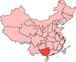
en: Location of Guangxi Zhuang Autonomous Region in the People's Republic of China. See Locator maps of province-level divisions of the People's Republic of China for more information.
zh: 廣西壯族自治區在中華人民共和國的位置。另見Locator maps of province-level divisions of the People's Republic of China。

|
Autorízase la copia, distribución y/o cambéu d'esti documentu baxo los términos de la Llicencia de documentación llibre GNU, versión 1.2 o cualesquier otra que nel futuru espublice la Free Software Foundation; ensin seiciones invariables, testos de portada, nin testos de contraportada. S'inclúi una copia de la llicencia na seición titulada GNU Free Documentation License. |
| Esti ficheru ta disponible baxo la llicencia Creative Commons Reconocimientu-Compartir igual 3.0 xenérica. | ||
| ||
| Esta etiqueta de llicencia s'amestó a esti ficheru como parte del anovamientu de la llicencia GFDL. |
Historial del ficheru
Calca nuna fecha/hora pa ver el ficheru como taba daquella.
| Data/Hora | Miniatura | Dimensiones | Usuariu | Comentariu | |
|---|---|---|---|---|---|
| actual | 18:12 28 och 2007 | | 268 × 218 (31 kB) | Croquant | transparent background |
| 22:35 4 xun 2005 |  | 268 × 218 (9 kB) | Ran | '''en''': Location of Guangxi Zhuang Autonomous Region in the People's Republic of China. See Category:Locator maps of province-level divisions of the People's Republic of China for more information. '''zh''': 廣西壯族自治區在中華人民共 |
Usu del ficheru
La páxina siguiente usa esti ficheru:
Usu global del ficheru
Estes otres wikis usen esti ficheru:
- Usu en da.wikipedia.org
- Usu en de.wikipedia.org
- Liuzhou
- Guilin
- Vietnamesen
- Mandschu
- Han (Ethnie)
- Hakka
- Hui-Chinesen
- Zhuang
- Nanning
- Wuzhou
- Yao
- Dong (Volk)
- Yi (Volk)
- Sui (Volk)
- Gelao
- Mulam
- Maonan
- Gaoshan
- Beihai (Guangxi)
- Yulin (Guangxi)
- Guigang
- Vorlage:Navigationsleiste Bezirksebene Guangxis
- Bose (Guangxi)
- Chongzuo
- Fangchenggang
- Hechi
- Hezhou
- Laibin
- Qinzhou
- Miao
- Vorlage:Navigationsleiste Nationalitäten in Guangxi
- Usu en en.wikipedia.org
- Haicheng District
- Tieshangang District
- Yinhai District
- Sanjiang Dong Autonomous County
- Wikipedia:WikiProject Chinese provinces/Locator maps
- Chengyang, Guangxi
- Shoumei tea
- Yingpan, Guangxi
- Yizhou District, Hechi
- Longzhou County
- Pingxiang, Guangxi
- Yu River (Guangxi)
- Yongfu County
- Lingui District
- Kunlun Pass
- Rong River (Guangxi)
- Gui River
- Beihai Fucheng Airport
Ver más usos globales d'esti ficheru.