Ficheru:Greater Manchester County (3).png
Tamañu d'esta previsualización: 800 × 582 pixels. Otres resoluciones: 320 × 233 pixels | 640 × 466 pixels | 1024 × 745 pixels | 1280 × 931 pixels | 2560 × 1862 pixels | 3358 × 2443 pixels.
Ficheru orixinal (3358 × 2443 píxels, tamañu de ficheru: 713 kB, triba MIME: image/png)
.png)
Resume
| Descripción |
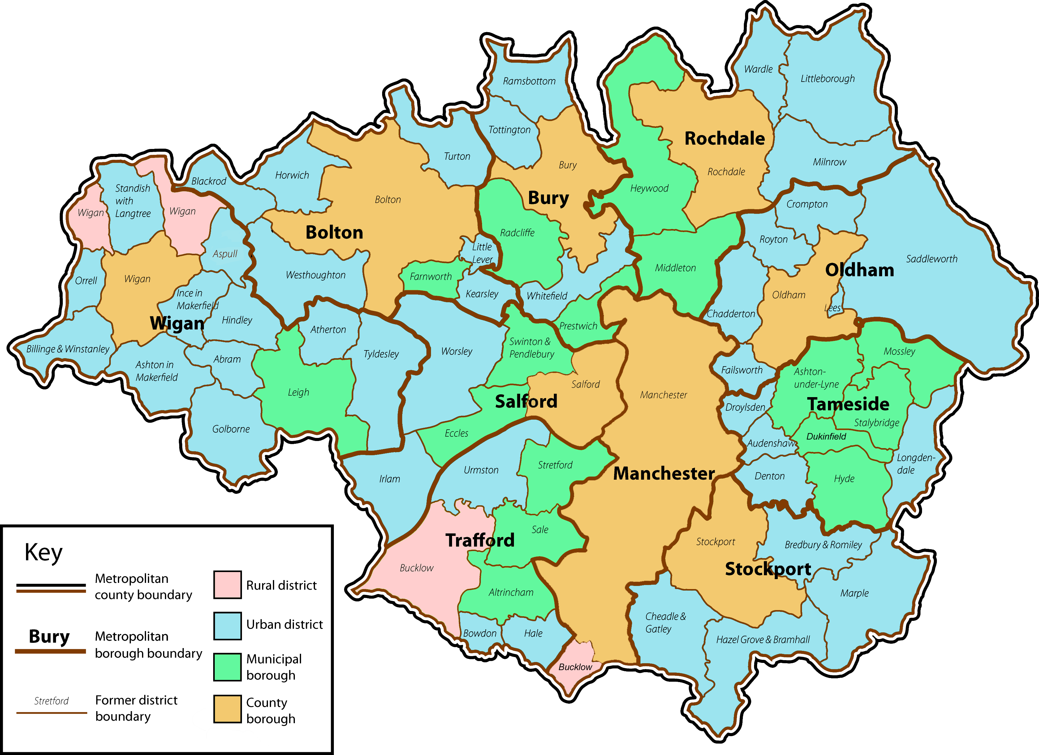
English: A map of the metropolitan county of Greater Manchester with the status of the former local government districts which now lie within its county boundaries. |
| Data | |
| Fonte | Own work by uploader. Content is verified at Her Majesty's Stationery Office (1974) Local Government in England and Wales: A Guide to the New System, Londres: HMSO ISBN: 0117508470. |
| Autor | Jhamez84 |
| Otres versiones |
 .png) |
Llicencia
| Yo, el titular de los drechos d'autor d'esta obra, la llibero como dominiu públicu. Esto s'aplica nel mundu ensembre. En dellos países seique esto nun seya posible llegalmente; nesti casu: Doi a cualesquier persona permisu pa usar esta obra pa cualesquier propósitu, ensin denguna condición, menos si eses condiciones requierense pola llei. |
Historial del ficheru
Calca nuna fecha/hora pa ver el ficheru como taba daquella.
| Data/Hora | Miniatura | Dimensiones | Usuariu | Comentariu | |
|---|---|---|---|---|---|
| actual | 02:12 14 xin 2009 | | 3358 × 2443 (713 kB) | Jza84 | fix Bucklow, Dukinfield and colour of Manchester and Salford. |
| 13:20 2 xnt 2008 |  | 3358 × 2443 (711 kB) | Jza84 | minor cosmetic amendments | |
| 00:22 2 xnt 2008 |  | 3358 × 2443 (715 kB) | Jza84 | fix key | |
| 00:04 2 xnt 2008 |  | 3358 × 2443 (715 kB) | Jza84 | {{Information |Description={{en|1=A map of the metropolitan county of Greater Manchester with the status of the former local government districts which now lie within its county boundaries.}} |Source=Own work by uploader |Author=Jhamez84 |
Usu del ficheru
La páxina siguiente usa esti ficheru:
Usu global del ficheru
Estes otres wikis usen esti ficheru:
- Usu en bn.wikipedia.org
- Usu en dag.wikipedia.org
- Usu en en.wikipedia.org
- Greater Manchester
- Greater Manchester County Council
- Civil parishes in Greater Manchester
- Longendale Urban District
- User:Jza84
- Wikipedia talk:WikiProject Greater Manchester/Archive 16
- User:Skinsmoke/Sandbox/Civil parishes/Greater Manchester
- Wikipedia:Graphics Lab/Map workshop/Archive/Dec 2010
- Grade I listed buildings in Greater Manchester
- Usu en es.wikipedia.org
- Usu en fa.wikipedia.org
- Usu en fr.wikipedia.org
- Usu en he.wikipedia.org
- Usu en it.wikipedia.org
- Usu en ru.wikipedia.org
- Usu en zh.wikipedia.org
.png)