Ficheru:Spain Valencian Community location map.svg

Tamañu de la vista previa PNG d'esti ficheru SVG: 442 × 600 pixels. Otres resoluciones: 177 × 240 pixels | 353 × 480 pixels | 566 × 768 pixels | 754 × 1024 pixels | 1509 × 2048 pixels | 512 × 695 pixels.
Ficheru orixinal (ficheru SVG, 512 × 695 píxels nominales, tamañu de ficheru: 538 kB)
Resume
| Descripción |
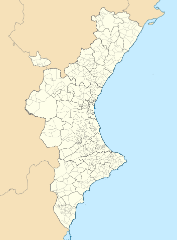
Català: Mapa de localització del País Valencià
Projecció equirrectangular, N/S estirada 130 %. Extrems geogràfics al mapa:
English: Location map of the Land of Valencia
Equirectangular projection, N/S stretching 130 %. Geographic limits of the map:
Español: Mapa de localización de la Comunidad Valenciana
Proyección equirrectangular, N/S estirada 130 %. Límites geográficos del mapa:
|
|
| Data | ||
| Fonte | Trabayu propiu basáu en: EspañaLoc.svg de HansenBCN, and Trabayu propiu basáu en: Mapa de localització a les comarques valencianes.svg de Martorell | |
| Autor | Miguillen and Martorell | |
| SVG desarrollo | El código fuente de esta imagen SVG es válido. Este mapa fue creado con Inkscape.
|
Llicencia
Miguillen, titular de los drechos d'autor d'esta obra, la espubliza baxo la siguiente llicencia:
Esti ficheru ta disponible baxo la llicencia Creative Commons Reconocimientu-Compartir igual 3.0 xenérica.
Reconocimientu: Miguillen
- Ye llibre:
- pa compartir – pa copiar, distribuir y comunicar públicamente la obra
- pa remezclar – p'adautar la obra
- Baxo les condiciones siguientes:
- reconocimientu – Tienes de dar el créitu apropiáu, apurrir un enllaz a la llicencia ya indicar si realizasti dalgún cambéu. Puedes faelo de cualquier mou razonable ,pero non de manera que suxera l'encontu del autor pa ti o pal usu que faigas.
- compartir igual – Si entemeces, tresformes o te bases nesti material, tienes de distribuir les tos contribuciones baxo la mesma llicencia o una compatible cola orixinal.
Historial del ficheru
Calca nuna fecha/hora pa ver el ficheru como taba daquella.
| Data/Hora | Miniatura | Dimensiones | Usuariu | Comentariu | |
|---|---|---|---|---|---|
| actual | 07:29 9 set 2022 | | 512 × 695 (538 kB) | Martorell | Added borders of comarques. |
| 14:39 25 may 2010 |  | 512 × 695 (494 kB) | Miguillen | == {{int:filedesc}} == {{Information |Description={{en|Location map of Valencian Community}} Equirectangular projection, N/S stretching 130 %. Geographic limits of the map: * N: 40.885909° N * S: 37.698098° N * W: 1.95368 |
Usu del ficheru
Les páxines siguientes usen esti ficheru:
Usu global del ficheru
Estes otres wikis usen esti ficheru:
- Usu en ar.wikipedia.org
- Usu en azb.wikipedia.org
- Usu en ba.wikipedia.org
- Usu en bg.wikipedia.org
- Usu en bn.wikipedia.org
- Usu en ca.wikipedia.org
- Usuari:PereBot/cobertura/País Valencià 2/ranking
- Usuari:PereBot/cobertura/País Valencià 2/an
- Usuari:PereBot/cobertura/País Valencià 2/ca
- Usuari:PereBot/cobertura/País Valencià 2/de
- Usuari:PereBot/cobertura/País Valencià 2/en
- Usuari:PereBot/cobertura/País Valencià 2/es
- Usuari:PereBot/cobertura/País Valencià 2/eu
- Usuari:PereBot/cobertura/País Valencià 2/fr
- Usuari:PereBot/cobertura/País Valencià 2/nl
- Usuari:PereBot/cobertura/País Valencià 2/ru
- Usuari:PereBot/cobertura/País Valencià 2/it
- Usuari:PereBot/cobertura/País Valencià 2/ar
- Usuari:PereBot/cobertura/País Valencià 2/no
Ver más usos globales d'esti ficheru.