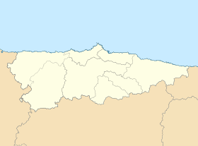
Castiellu (Villaviciosa)
parroquia del conceyu de Villaviciosa (Asturies)
Castiellu[2] ye una parroquia del conceyu de Villaviciosa, n'Asturies.
 | |
| Alministración | |
| País | |
| Autonomía | |
| Provincia | |
| Conceyu | |
| Partíu xudicial | Villaviciosa |
| Tipu d'entidá | parroquia d'Asturies |
| Xeografía | |
| Coordenaes | 43°31′30″N 5°31′36″W / 43.52493°N 5.52654°O |
| Superficie | 7.256 km² |
| Altitú | 150 m[1] |
| Llenda con | Villaverde, Quintes, Arroes, Niévares y San Xusto |
| Demografía | |
| Población | 365 hab. (2020) |
| Porcentaxe |
2.43% de Villaviciosa 0.04% de provincia d'Asturies 0.04% de Principáu d'Asturies 0% de España |
| Densidá | 50,3 hab/km² |
| Más información | |
| Estaya horaria | UTC+01:00 |
Llocalidaes
editar| Nᵘ | Nome
|
Población | % población Castiellu (Villaviciosa)
|
|---|---|---|---|
| 1 | Bárzana
|
n/d
| |
| 2 | Bustiellu
|
n/d | |
| 3 | La Carbayera
|
n/d | |
| 4 | La Floría
|
n/d | |
| 5 | La Vega
|
n/d | |
| 6 | Los Piñares
|
n/d | |
| 7 | Piñole
|
n/d | |
| 8 | Torreteyera
|
n/d | |
| 9 | Venta les Ranes
|
n/d |
Sitios
editar- Cañéu
- El Fontín
- La Moyada
- La Rasa
- Valvidares
Referencies
editar- ↑ Afirmao en: Modelo Digital del Terreno de España de 5 metros. Editorial: Institutu Xeográficu Nacional d'España.
- ↑ «Espediente colos topónimos oficiales de Villaviciosa». BOPA.
Enllaces esternos
editar| Parroquies de Villaviciosa | ||
|---|---|---|
| Amandi | Argüeru | Arnín | Arroes | Bedriñana | Breceña | El Bustiu | Camoca | Candanal | Carda | Careñes | Castiellu | Cazanes | Celada | Coru | Fuentes | Grases | La Llera | Llugás | La Madalena | Miravalles | Niévares | Oles | Pion | Priesca | Pueyes | Quintes | Quintueles | Rales | Rozaes | Samartín de Vallés | Samartín del Mar | San Pedru Ambás | San Xusto | Santoxenia | Seloriu | Tazones | Tornón | Valdebárcena | Villaverde | Villaviciosa | ||
